
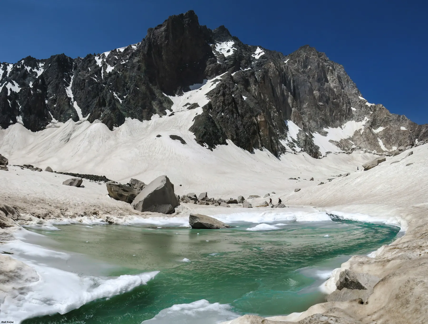
Alam Kuh (also Alam-Kuh or Alamkouh) is the best-known summit of the Takht-e Soleyman massif, a knot of high peaks in the central Alborz. It lies in Mazandaran, in the Kelardasht district, north of the Takht-e Soleyman crest and within reach of the Caspian forests on the northern side of the range. Wikipedia’s lead figure is 4,850 metres. The same article’s sources then disagree: Peaklist has cited about 4,805 metres from Soviet mapping and SRTM, Peakbagger lists 4,826 metres, and a glaciological paper has used 4,835 metres. It is often called the second-highest summit in Iran. That ranking only holds if the elevation you accept sits above Sabalan. This page does not settle the argument.
Summit coordinates in public databases cluster near 36.376° N, 50.961° E. Round them onto your own map before you navigate.
Geographic setting
The massif is not a single cone. It is a group of peaks, ridges, and high basins. Alam Chal, the basin under the north side of Alam Kuh, holds a glacier that has been measured and photographed. The lake and the moraines in the photographs on this page are that basin. They show snow patches and late-season ice, not a guaranteed winter ski line.
What the mountain is like
The north wall is a serious rock face. One photograph here shows it in spring, with a climbing rope in the foreground. That picture is included so the character of the peak is honest. It is not a ski photograph, and the caption says so. Granite, loose blocks, and a long walk from the valley are the ordinary facts of an approach. Winter adds snow, ice, short days, and avalanche terrain in the gullies and on the approach slopes.
Ski mountaineering
Ski mountaineers do travel in this massif. The terrain rewards parties who can move on skis and who can also deal with rock and ice when the skis come off. This page does not name a couloir, a grade, or a descent length. Those details change with the snow year, and copying them from a trip report would pretend they are stable.
Terrain and technical character
Treat Alam Kuh as a technical mountain, not as a snow dome. Glacier travel in Alam Chal means crevasse hazard where the glacier is still ice, and a different hazard where it has become steep snow over rock. The wall itself is a climbing objective. A ski journey that only “visits the area” and a journey that tries a line under the wall are not the same project. Say which one you mean when you inquire.
Access
Approaches from Kelardasht, including the Rudbarak valley, are the ones commonly described. The roadhead moves with the season and with local conditions. Confirm it in the year you go. This site does not publish a walking time.
Season
The photographs of the lake and the moraines are not mid-winter images. Winter and spring are when ski travel is realistic. Summer and autumn are for rock and for seeing what the glacier looks like when the snow has pulled back. Do not read a summer picture as a snow report.
Safety
Remoteness matters here. The massif is not beside a resort patrol. Weather on the Caspian side of the Alborz can load slopes. Altitude is lower than Damavand and still high enough to notice. Navigation in cloud on a complicated ridge is a separate skill from skiing. No condition report is published on this site.
Photographs still needed
A winter ski photograph from this massif, licensed for the site, is listed on the credits page. The rope in the wall photograph stays visible so nobody mistakes that frame for a descent.