
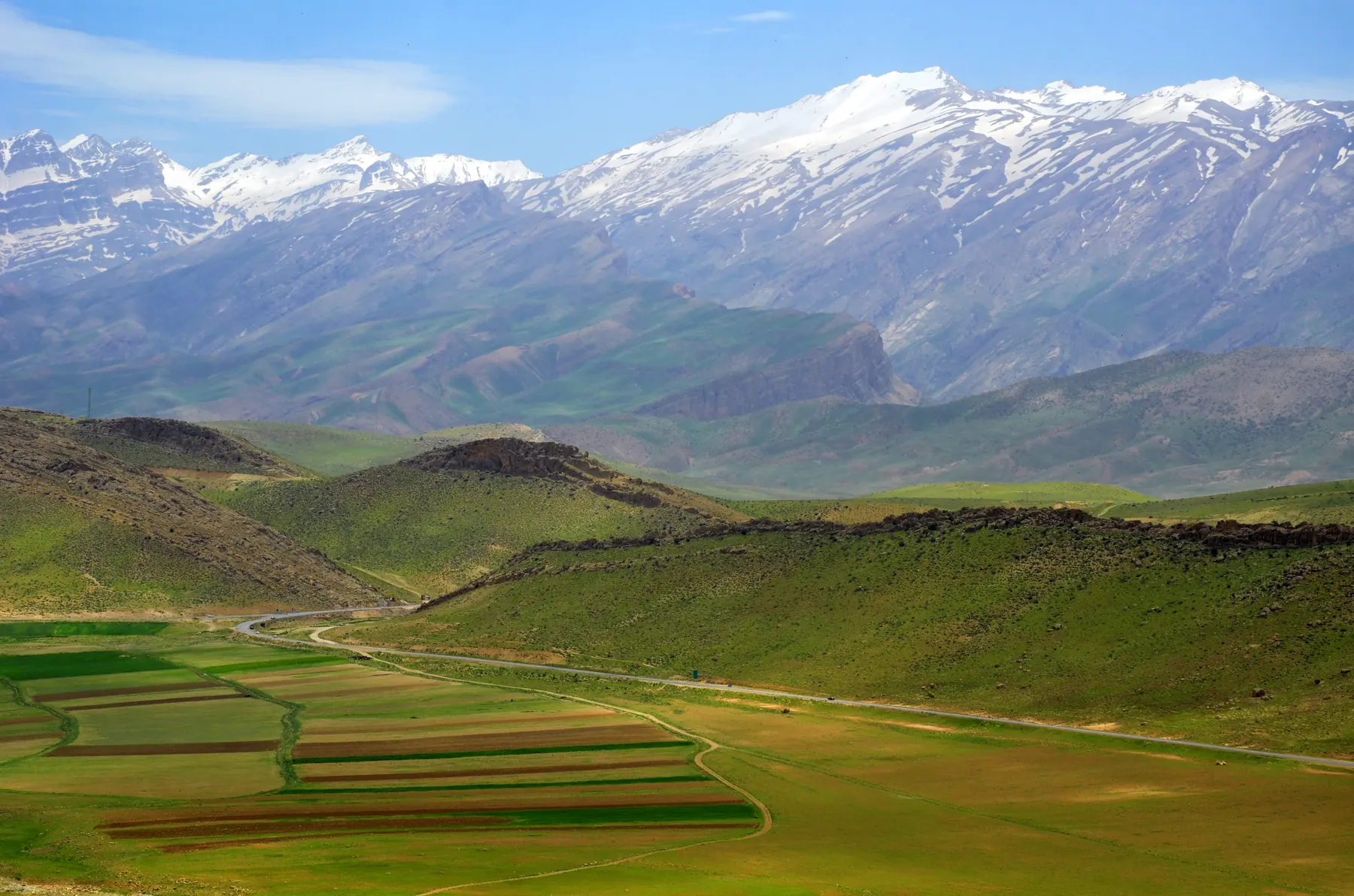
Dena is a massif, not one summit with a view. English-language geographic summaries describe a crest on the order of 80 kilometres; Persian Wikipedia describes about 90. Dozens of points along it rise above 4,000 metres. The highest is Qash-Mastan, also written Ghash-Mastan and Bijan 3. English Wikipedia, and a 2024 biogeographical paper on the Dena Mountains, use 4,409 metres. Persian Wikipedia lists 4,459 metres. Both numbers are in circulation. This site will not pretend they are the same mountain measured once.
The massif lies in the Zagros, primarily in Kohgiluyeh and Boyer-Ahmad Province, with Yasuj the nearest provincial capital. The north side is seen from the Yasuj–Semirom road. Coarse summit coordinates published with the English Wikipedia entry are 30.95° N, 51.43° E. They are too coarse for navigation.
Geographic setting
Below the crest are cultivated valleys, oak woodland on some slopes, and dry hills, depending on the side and the month. The photographs on this page show that contrast: snow on the skyline, green or brown country in front. Part of the landscape is protected. Confirm whether your approach enters a protected area, and which rules apply, before you treat a valley as open country.
What the mountain is like
The skiing, when the snow is there, is on a long ridge system rather than on an isolated cone. Approaches gain a lot of height from villages and roads that sit far below the crest. March photographs can show a white skyline and a dry foreground at the same time. That is a real condition, not a failure of the picture.
Ski mountaineering
Ski touring on Dena is discussed by people who ski the southern Zagros, often with a base on the Yasuj side or in villages under the crest. This page does not name a valley, a grade, or a descent. Snow on the skyline in a photograph is not a ski report.
Terrain and technical character
Route-finding along a crest of many summits is easy to underestimate from the road. Cornices, wind, and the sheer length of the ridge matter as much as the steepness of any one slope. Rescue is not around the corner. Technical difficulty is left unstated on purpose.
Access
Yasuj is the usual city reference. The Semirom road is a way to see the massif, not automatically a way to start a ski tour. Winter roads in the Zagros close. Ask in the season you are travelling, and do not rely on a summer driving time.
Season
Snow is a winter and spring condition on the high crest. The lower valleys green up while the summits are still white, which is exactly what the Semirom photograph shows. The useful ski window is a local judgment.
Safety
Length, weather, and distance from help are the structural hazards. Avalanche terrain exists wherever snow sits on a slope of consequence. Altitude is lower than Damavand and still a factor if you sleep high. Protected-area rules are a safety question as well as a legal one, because a closed valley is not a backup plan. Nothing on this page is a condition report.
Photographs still needed
A photograph of people on skis in the Dena, taken there and licensed for this site, is still missing. See the credits page.